Overview
Canterbury is New Zealand’s largest region by area, stretching from the Pacific coast in the east across the wide, windswept Canterbury Plains to the spine of the Southern Alps in the west. It is a region defined by drama: the rebuilt, creative city of Christchurch at its heart; the turquoise glacier lakes and high alpine peaks of Aoraki/Mount Cook National Park; the coastal drama of Kaikōura, where mountains tumble into the sea creating one of the world’s richest marine ecosystems; and the vast, tussock plains of the Mackenzie Basin.
Christchurch — still fondly known as the Garden City — has emerged from the devastating 2010–11 earthquake sequence as one of Australasia’s most architecturally interesting and culturally dynamic cities. The rebuild has been thoughtful, innovative, and occasionally breathtaking, with a new precinct of public art, laneway dining, and creative spaces. Visitors sometimes ask whether Christchurch is worth visiting post-earthquake — the answer is emphatically yes; the rebuilt city is more interesting, more walkable, and more vibrant than its predecessor.
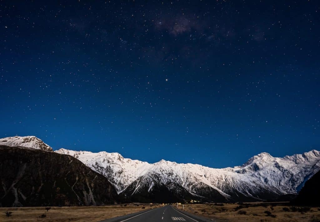
The Canterbury region is also the gateway to the central South Island’s greatest landscapes. The Twin Lakes of Tekapo and Pukaki glow an otherworldly turquoise under vast, star-filled skies — the Mackenzie Basin is part of one of only three International Dark Sky Reserves in the Southern Hemisphere, where you can stargaze from the shores of a glacial lake surrounded by the Southern Alps.
Top Things to Do in Canterbury
Aoraki/Mount Cook National Park
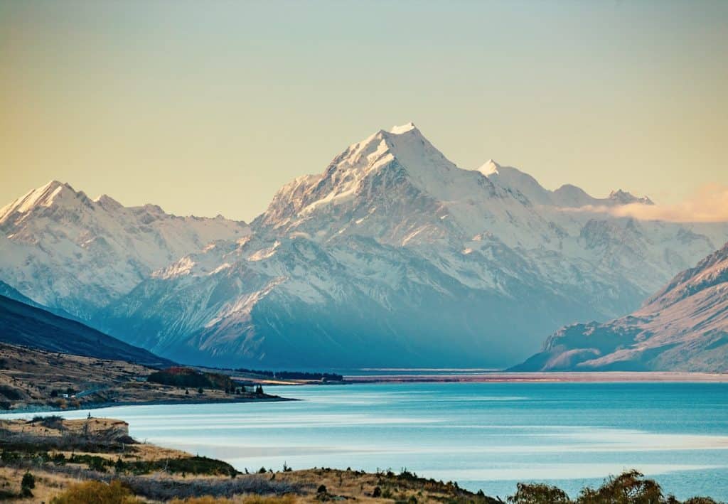
New Zealand’s highest mountain (3,724m) anchors a national park of stunning alpine grandeur within Te Wahipounamu World Heritage Area. The Hooker Valley Track is New Zealand’s most spectacular easy day walk — a flat, well-formed track leading through braided glacial rivers, past two swing bridges, to a terminal lake filled with icebergs calved from the Hooker Glacier, with Aoraki’s summit wall filling the entire horizon. Guided alpine climbing, ski-plane flights, and glacier heli-tours are also world-class. The drive from Christchurch via Tekapo takes approximately 3.5–4 hours.
Kaikōura — Marine Wildlife Capital
Kaikōura sits where the Kaikōura Peninsula juts into the sea at the intersection of the Kaikōura Canyon submarine trench — a nutrient-rich upwelling that supports an extraordinary diversity of marine life. Sperm whales are resident year-round (the only place in New Zealand with this distinction), and the waters also host dusky dolphins, NZ fur seals, wandering albatross, and in season, humpback whales, blue whales, and migrating orca. Whale Watch Kaikōura is one of the world’s most respected wildlife tour operators. The two-hour coastal drive from Christchurch along State Highway 1 between the mountains and the sea is spectacular.

Lake Tekapo & Aoraki Mackenzie Dark Sky Reserve
The turquoise waters of Lake Tekapo, fed by glacial meltwater from the Southern Alps, frame one of New Zealand’s most photographed landmarks — the tiny stone Church of the Good Shepherd on the lakeshore. At night, the Mackenzie Basin’s extreme remoteness and dry climate create near-perfect stargazing conditions in one of the largest dark sky reserves in the world. The Earth & Sky observatory at Mount John (accessible by shuttle or on foot) offers guided stargazing experiences with powerful telescopes. Tekapo’s lupins in full bloom from November to January are another major draw.
Christchurch — The Rebuilt Garden City
New Zealand’s second-largest city has reimagined itself after the 2011 earthquakes with remarkable creativity. The new central city features the innovative Cardboard Cathedral designed by Japanese architect Shigeru Ban, the beautifully restored Canterbury Museum, the Ōtākaro Avon River Corridor parklands, and the Re:START Container Mall — a landmark of post-disaster urban creativity. The Christchurch Botanic Gardens remain one of the finest public gardens in the Southern Hemisphere. The city’s tram network has been restored and provides a great introduction to the central city for first-time visitors.
Akaroa & Banks Peninsula
An hour’s drive east of Christchurch, the Banks Peninsula is a volcanic massif jutting into the Pacific, its eroded craters forming two large harbours — Lyttelton and Akaroa. The French-influenced village of Akaroa, founded in 1840 by French settlers, sits at the head of a beautiful harbour flanked by dramatic green volcanic walls. Akaroa is famous for swimming with the world’s smallest dolphin — the Hector’s dolphin — on guided tours, and for its exceptional dining and artisan food scene. The Summit Road around the rim of the old Banks Peninsula volcano offers extraordinary views on a clear day.

Mount Hutt & Canterbury Ski Fields
Canterbury is the ski capital of New Zealand’s South Island, with the region’s ski fields centred on the foothills and main ranges of the Southern Alps above the Canterbury Plains. Mount Hutt, 90 minutes from Christchurch, is the country’s premier ski resort — a wide, high-altitude field with one of the longest ski seasons in New Zealand (typically June to October) and reliable snow. For those seeking more character, the smaller club fields of Porters, Mt Cheeseman, and Temple Basin offer a uniquely New Zealand back-country ski experience with rope tows and stunning wilderness settings.

Cave Stream Scenic Reserve
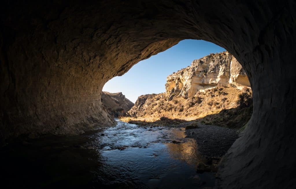
The cave takes approximately 45 minutes to traverse from the downstream entrance to the exit at the top, moving against the current the entire way. Water depth varies from ankle-deep to chest-high depending on rainfall and season, and the passage requires ducking through low sections, scrambling over submerged boulders, and navigating one short waterfall climb near the exit using fixed handholds cut into the rock. A torch (or ideally a waterproof headlamp) is essential — the cave is pitch black within minutes of the entrance, and the limestone walls close in to less than a metre in places. Water temperature sits around 8–10°C year-round, making a wetsuit or thermal underlayer strongly advisable outside of summer.
Cave Stream is suitable for fit, confident adults and older children comfortable in cold water and confined spaces. It should never be entered during or after heavy rain, when the stream rises rapidly and the cave becomes genuinely dangerous — the Department of Conservation posts clear flood-risk warnings at the entrance and these should be taken seriously. The reserve sits 40 minutes west of Springfield and makes a natural stop on the drive between Christchurch and Arthur’s Pass, pairing well with the short walks and café at Arthur’s Pass village.
Getting there and around
Christchurch Airport is the South Island’s main international gateway, with direct flights from Australia and the Pacific as well as connections to every major New Zealand city, sitting about 20 minutes from the city centre. The TranzAlpine train departs Christchurch for the West Coast, and InterCity buses fan out across the region and further afield.
Christchurch’s compact, rebuilt central city and tram and bus network make it easy to get around without a car, but a hire car comes into its own for exploring the wider region — the Mackenzie Basin, Aoraki/Mount Cook, and Kaikōura’s coastline are all a comfortable drive away with limited or no public transport once you’re outside the city.


Author: Tripplanner Team
The Tripplanner.nz editorial team, based in Matakana north of Auckland. We write the regional guides and road trips, and add listings for places we think every visitor should know about, alongside the locals who share their own favourite spots here.