Art Deco architecture, world-class wine, and coastal sunshine
Overview
Hawke’s Bay is a region on the east coast of New Zealand’s North Island, centred on the twin cities of Napier and Hastings. The region receives an average of 2,200 sunshine hours annually, making it one of the driest and sunniest parts of the North Island. Napier is internationally recognised for its concentration of Art Deco and Spanish Mission architecture, rebuilt almost entirely after a magnitude 7.8 earthquake in 1931 that killed 256 people and flattened the city centre. Hawke’s Bay produces approximately 20 percent of New Zealand’s total wine output, with a strong focus on Bordeaux-style red varieties, Chardonnay, and Syrah grown across the Heretaunga Plains and hillside terraces. The region is also home to one of the largest Australasian gannet colonies in the world at Cape Kidnappers.
Best For
Wine touring, architecture, coastal walks, cycling, food and dining, families
Accessibility
Napier’s flat Marine Parade and central city are accessible for wheelchair users and mobility scooters. The Art Deco Heritage Walk is largely flat with good footpath surfaces. The MTG Hawke’s Bay museum is fully accessible. Cellar door accessibility varies — Craggy Range, Church Road, and Te Mata Estate all have accessible facilities.
Top Things to Do
Napier Art Deco Precinct
Napier’s central city contains one of the world’s finest collections of Art Deco commercial architecture, concentrated in a 10-block area along Emerson Street, Hastings Street, and Marine Parade. The Art Deco Trust runs guided walking tours daily, and the annual Art Deco Festival in February attracts over 30,000 visitors in period costume. Self-guided trail maps are available from the i-SITE visitor centre.

Cape Kidnappers Gannet Colony
Cape Kidnappers hosts a mainland Australasian gannet (tākapu) colony of approximately 6,500 breeding pairs — one of the largest and most accessible in the world. The colony is located at the tip of a dramatic cape 30 kilometres south of Napier. Access is by guided tractor trailer tour from Clifton or on foot during low tide between October and April.

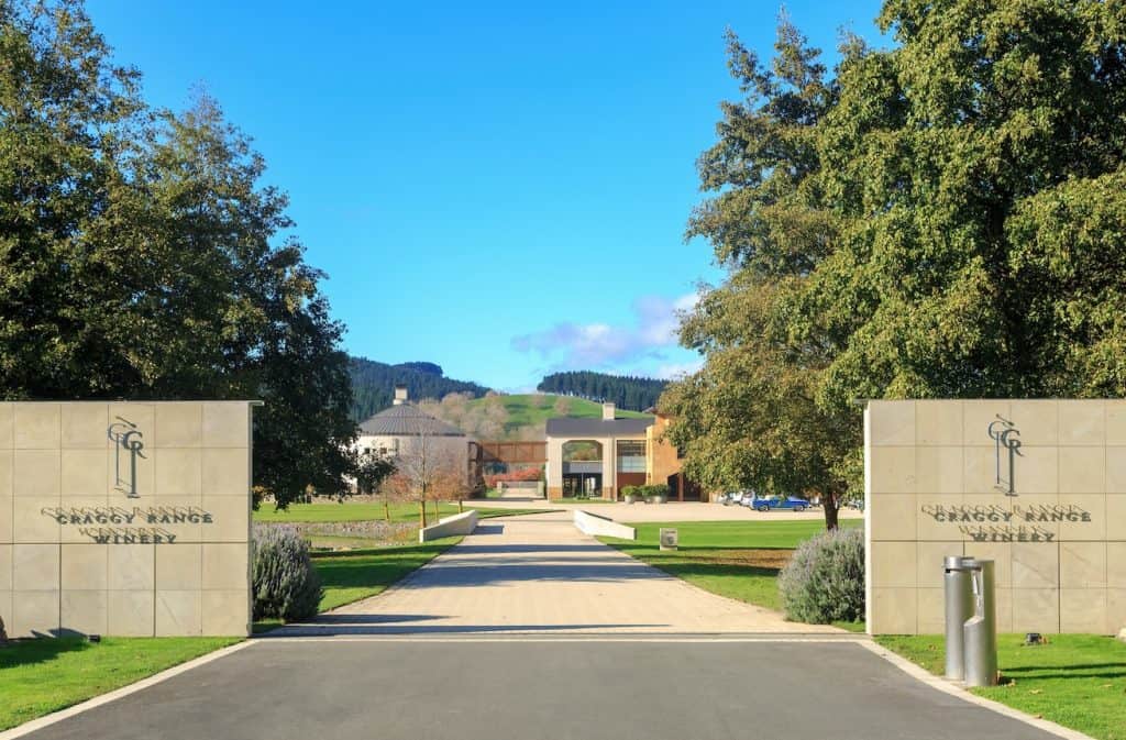
Hawke’s Bay Wine Trail
As New Zealand’s oldest wine region and an official Great Wine Capital of the World, Hawke’s Bay is a premier destination for exceptional cellar door experiences. The region’s unique microclimates and ancient riverbeds—most notably the sun-baked, stony soils of the acclaimed Gimblett Gravels and the Bridge Pa Triangle—produce world-class, full-bodied Syrahs, complex Bordeaux-style red blends, and beautifully oaked Chardonnays.

Mapping a tasting route along the famous Hawke’s Bay Wine Trail connects more than 20 cellar doors across sub-regions like Havelock North and Esk Valley, highlighting iconic producers such as Craggy Range, Church Road, and Te Mata Estate (established in 1896). Whether you choose to explore the historic estates of Mission Estate in Napier or take advantage of the flat Heretaunga Plains for a leisurely cycling tour between vineyards, a journey through these celebrated estates offers a perfect mix of rich heritage, award-winning architecture, and unforgettable wine-tasting experiences.
Te Mata Peak
Te Mata Peak rises 399 metres above the Heretaunga Plains and offers 360-degree views across Hawke’s Bay, the Kaweka and Ruahine Ranges, and the Pacific coastline on clear days. The peak is sacred to Ngāti Kahungunu and features prominently in local legend. A sealed road reaches near the summit, with a short walking track to the trig point.

Getting There
Hawke’s Bay Airport (NPE) near Napier is served by Air New Zealand from Auckland, Wellington, and Christchurch. The drive from Wellington takes approximately 4 hours via State Highway 2 through the Manawatū Gorge route or Pahiatua Track. From Auckland, the drive is approximately 4.5 hours via State Highway 2 through Taupo.
Author: Mike Fernandez
Hey! I've worked for Nection Ltd since 2018 and been writing for Tripplanner since late 2025. I love it that this is a place where people can tell everyone about where they're from and hopefully bring tourists in. I'm from Matakana (which is why there's so many listings from there!) I had fun making them, I hope you like them too.