The Tongariro Alpine Crossing is widely regarded as New Zealand’s greatest day hike — and once you’ve done it, you’ll reckon that’s no exaggeration. This legendary 19.4 km one-way trek cuts right through the heart of Tongariro National Park, a dual UNESCO World Heritage Site on the Central North Island, threading you past steaming volcanic vents, ancient lava fields, and the jaw-dropping Emerald Lakes. It’s the kind of walk that makes you go ‘yeah, nah’ to ever doing a boring trail again.
Often listed among the top ten single-day treks in the world, the Tongariro Alpine Crossing packs an extraordinary variety of landscapes into a single full day. You’ll start in tussock-covered valleys, grind up volcanic scree to Red Crater at 1,886 metres — the high point of the crossing — then descend past the luminous Emerald Lakes (Ngā Rotopounamu) before dropping through native bush to the finish. The terrain shifts from moonscape to alpine meadow to lush forest, keeping every kilometre interesting.
What to Expect on the Track
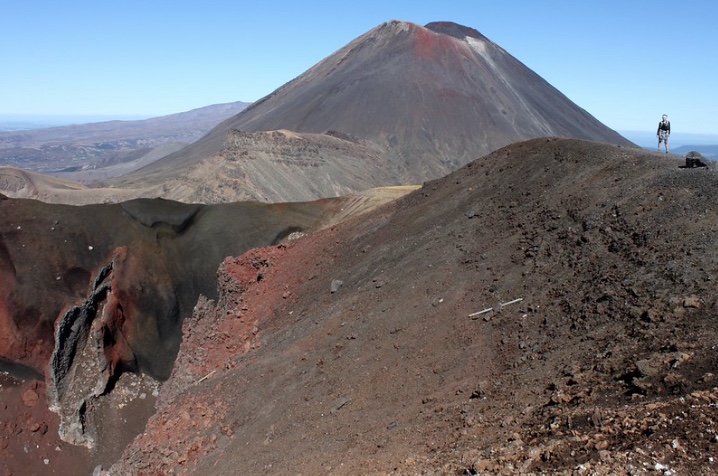
The crossing is walked point-to-point, starting at Mangatepopo Road End and finishing at Ketetahi Road End — so you’ll need a shuttle sorted before you lace up your boots. The first section through Mangatepopo Valley is relatively flat and a good warm-up, with views of Mount Ngauruhoe (yes, that’s Mt Doom from Lord of the Rings) building as you go. Make sure you check the weather the night before, as conditions on the exposed alpine terrain can turn savage in a hurry, even in summer.
The crux of the crossing is the steep climb known as the Devil’s Staircase, which gains around 350 metres of elevation up to South Crater. From there the route continues to Red Crater, where the smell of sulphur and the sight of fumaroles remind you that this is a genuinely active volcanic landscape — Tongariro National Park has seen eruptions as recently as 2012. The descent from Red Crater to the Emerald Lakes is steep and loose underfoot, so take your time and watch your footing.
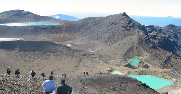
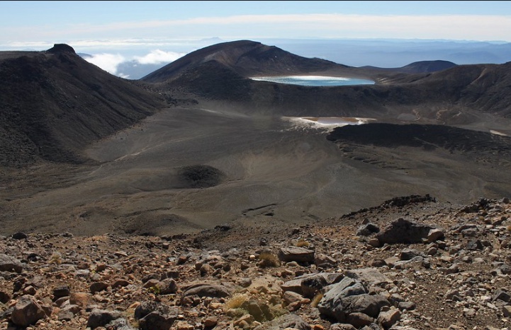
The Emerald Lakes are the undisputed highlight. Their vivid turquoise and jade hues come from minerals leaching from the surrounding geothermal environment — they glow like something out of a fantasy film on a clear day. This is the perfect spot to crack open your lunch and take it all in. From here the track passes the Blue Lake (Te Wai Whakaata o te Rangihīroa) and rolls through the Central Crater before a long descent through tussock and native forest to the finish.
Cultural Significance
Tongariro National Park holds deep spiritual and cultural significance for Ngāti Tūwharetoa and local Māori. The volcanoes — Tongariro, Ngauruhoe, and Ruapehu — are regarded as tūpuna (ancestors) and taonga (treasures). The park is in fact New Zealand’s first national park, gifted to the nation by paramount chief Te Heuheu Tūkino IV in 1887 to ensure the mountains would be protected for everyone.
Visitors are respectfully asked not to climb the summit of Mount Ngauruhoe, which is sacred to the local iwi. The track markings to the summit have been removed accordingly. Please stay on the marked trail and help look after this incredible place for future generations — as the Tiaki Promise says, care for New Zealand and it will care for you.
Planning Your Day Hike
Getting there: No private parking is available at Mangatepopo during summer (November–April). Shuttle services operate from Tūrangi, National Park Village, and other nearby towns. Booking ahead is strongly recommended, especially on weekends.
Best time to go: November to April offers the most reliable conditions. January and February are peak season — expect 1,000+ fellow trampers. For a quieter experience, aim for shoulder season (November or March–April) on a weekday.
What to bring: Sturdy hiking boots, layered clothing (including a waterproof jacket and pants), plenty of water (at least 2 litres — no safe drinking water on track), snacks, sunscreen, and a first aid kit.
Booking: A free track booking is required if using a shuttle or guided walk service. Book via the Department of Conservation (DOC) website before your visit.
Fitness level: The crossing is rated hard and requires good fitness. The total elevation gain is around 770 m and descent over 1,100 m. Allow 7–8 hours of steady walking plus breaks.
Winter conditions: From May to October, the route becomes a serious alpine undertaking requiring crampons, ice axe, and experience. DOC strongly recommends guided trips in winter.
The Tongariro Alpine Crossing passes through active volcanic terrain — volcanic risk is present even when the track is open. Monitor the GeoNet website for volcanic activity alerts before and during your trip. Weather on the exposed ridgeline can change from warm and sunny to whiteout conditions in under an hour — always carry full wet-weather gear regardless of the forecast.
There is no safe drinking water on the track so ensure you have plenty!