Rainforest, glaciers, and dramatic alpine passes — the wild, untamed drive down New Zealand’s least-populated coastline.
Region: West Coast
Suggested Duration: 4–6 days
Distance: Approx. 480km one way
Best For: Adventure travellers, hikers, and anyone wanting raw, undeveloped wilderness
Best Time to Go
Summer and early autumn (December–April) are the warmest but June and July are the most likely to give you dry, clear, and crisp days. That said, the West Coast can deliver rain in any season. Winter brings snow to Haast Pass and colder glacier valley conditions, but also dramatically quieter roads and townships.
Overview
The West Coast has a reputation among New Zealanders as the country’s wild edge — fewer people, more rain, and a frontier character that’s mostly disappeared elsewhere. The drive south from Greymouth to Wanaka follows State Highway 6 through some of the most dramatically varied landscape in the country: temperate rainforest, glacier-fed rivers, and two of the few glaciers in the world that descend into rainforest.
This is a longer, slower route than most South Island road trips, and that’s part of the appeal. Distances on the map look modest, but winding roads and worthwhile detours mean four to six days is realistic for doing it properly.
Greymouth to Hokitika
The short hop south to Hokitika introduces the region’s character — a town built on gold rush history and now known for greenstone (pounamu) carving, a material with deep significance in Māori culture. The Hokitika Gorge, a 40-minute drive inland, offers a glacial-blue swimming hole framed by rainforest that’s become one of the West Coast’s most photographed spots.

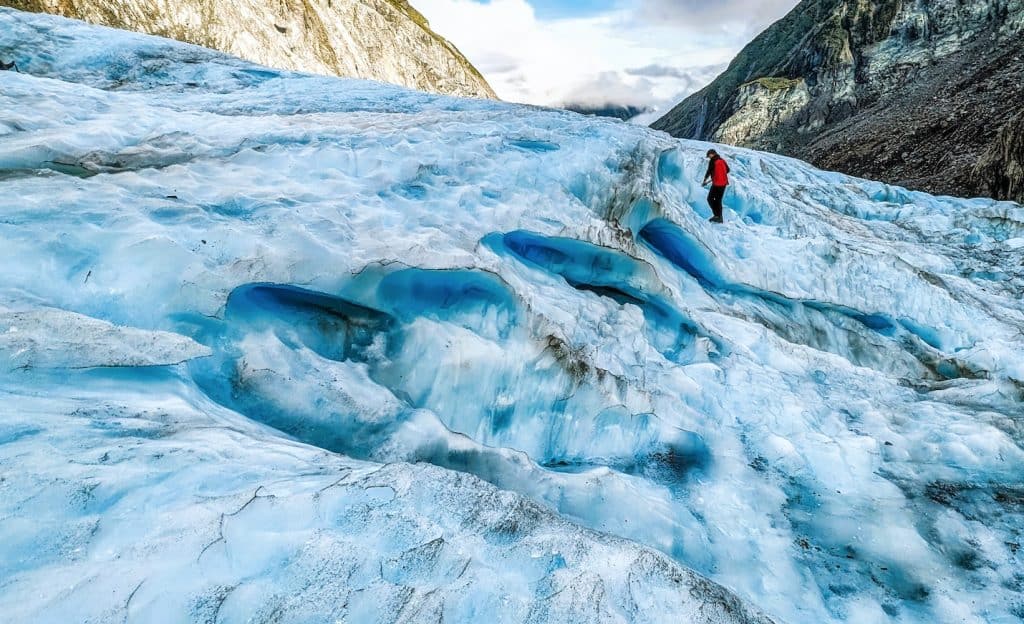
Franz Josef and Fox Glacier
Continuing south, the twin glacier towns of Franz Josef and Fox Glacier are the trip’s centrepiece. Both glaciers have retreated significantly in recent decades, and viewing access changes regularly — current guided walks typically use helicopter access onto the ice itself, since walking tracks to the glacier face have become less viable as the ice has receded.
Even without a glacier walk, the valley walks to viewing points are worthwhile, framed by rainforest that grows improbably close to permanent ice — a juxtaposition unique to this stretch of coast.
Haast Pass to Wanaka
South of Fox Glacier, the highway becomes genuinely remote, tracking the coastline before turning inland at Haast and climbing through Haast Pass — one of the lowest and most reliably accessible routes across the Southern Alps. The pass road follows the Haast River through dense beech forest, with several waterfalls (Thunder Creek Falls and the Blue Pools among them) worth the short detours.
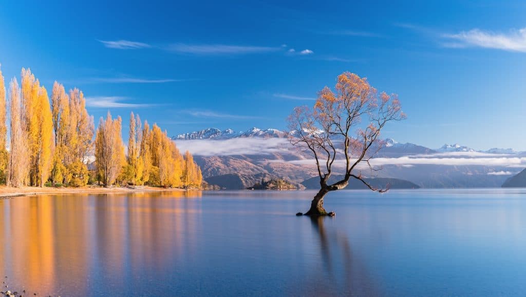
Emerging on the eastern side near Lake Wānaka marks a dramatic shift — the dense, wet West Coast bush gives way abruptly to the dry, golden tussock landscape of Central Otago, with Wānaka itself offering a relaxed, lake-side finish to the drive.
Practical Notes
- The West Coast genuinely lives up to its rainfall reputation — pack for wet weather regardless of season – but your best bet to see some dry days is to plan in June or July.
- Glacier access and guided walk availability changes due to ongoing retreat — check current operator offerings before planning
- Fuel stops are infrequent south of Franz Josef — fill up at every opportunity
- Haast Pass can experience closures after heavy rain or snow in winter — check road conditions before departing
Getting there
You can’t fly to Greymouth but that’s actually a great thing! Travelling this route will probably mean you’ve come from Nelson or Picton. You can fly to both places and also arrive in Picton via the ferry from Wellington. That means you’ll be driving through the Murchison Valley and Buller Gorge. Both places are absolutely beautiful and, if you’ve arrived by ferry, you also get to drive the Queen Charlotte Drive between Picton and Nelson.
Once you hit the coast around Westport, you’ll have the choice to take a detour north to Karamea and the Oparara Basin. Check out the longer post on the West Coast that includes this and the Pancake Rocks.
Author: Mike Fernandez
Hey! I've worked for Nection Ltd since 2018 and been writing for Tripplanner since late 2025. I love it that this is a place where people can tell everyone about where they're from and hopefully bring tourists in. I'm from Matakana (which is why there's so many listings from there!) I had fun making them, I hope you like them too.