Twin coasts, ancient forests, and New Zealand’s spiritual edge — a North Island road trip from Auckland to the top of the country.
Region: Northland / Bay of Islands
Suggested Duration: 4–5 days
Distance: Approx. 900km return
Best For: First-time visitors, families, photographers, and anyone wanting two coastlines in one trip
Best Time to Go
Late spring through early autumn (October to April) offers the most reliable weather, though the Far North rarely gets genuinely cold. Summer school holidays bring crowds to the Bay of Islands specifically, so shoulder season — March, April, or October — tends to offer the best balance of good weather and quieter roads.
Overview
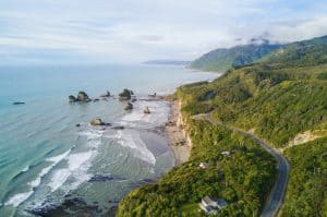
There’s a particular kind of quiet that settles in once you cross the Brynderwyn Hills heading north out of Auckland. The traffic thins, the hills roll wider, and the Pacific starts showing up on both sides of the road at once. This is the Far North Loop — one of New Zealand’s most rewarding road trips, and one locals tend to undersell because it’s so close to the city that it feels almost too easy to plan.
The route runs from Auckland up through Whangārei and the Bay of Islands to Cape Reinga, the windswept point where the Tasman Sea meets the Pacific Ocean, then loops back down the west coast through the kauri forests of the Hokianga and Waipoua before returning south. Most people do it in four to five days, though it rewards a slower pace if you have it.
Auckland to the Bay of Islands
Leave Auckland early and you could get to the Bay of Islands by mid-afternoon, but resist the urge to rush this stretch. First of all, you have many ways to get to Whangarei which is the first and largest city on the way north. You have the direct route on State Highway 1, the not-so-direct but pretty harbour route on SH16 until it meets SH1, and the long way which includes a stop off in Matakana. If you make it on Saturday morning you’ll catch the hugely popular Matakana market and other attractions around the area.
Even though the indirect routes are longer they’re totally worth it (and it IS a road trip!). If you take the harbour you could check out the Gibbs Farm open days to see if you can buy a ticket. It’s an absolutely incredible (and massive) sculpture exhibit.
Once you reach Whangārei, stop off at Whangarei Falls. It’s a short detour worth taking especially after some rain — a 26-metre drop into a swimming hole that’s at its best in the late morning light.

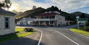
Further north, Paihia and Russell make a natural overnight base. Russell, the country’s first permanent European settlement, has a slower, salt-air charm that’s easy to underestimate from the ferry queue. It’s usually best to take a ferry from Opua rather than drive around. And close by is Haruru Falls if you didn’t get your water fix in Whangarei which also has a lovely walk.

The Waitangi Treaty Grounds sit just outside Paihia and deserve more than a drive-by. This is where the Treaty of Waitangi was signed in 1840, and the guided tour gives genuine context to a site that shaped the country’s modern identity.
Into the Far North
North of the Bay of Islands the landscape changes character. Farmland gives way to scrubby coastal hills, and the towns get further apart. Kerikeri is worth a stop for its citrus orchards and the historic Stone Store, New Zealand’s oldest surviving stone building. And not far away From there it’s a more remote run up through Kaitaia toward Cape Reinga.
The drive along Ninety Mile Beach — which is, depending on who you ask, closer to fifty-five miles — is one of the few legal beach driving stretches left in the country, though most visitors are better served taking a guided tour given the tide timing and soft sand risks.
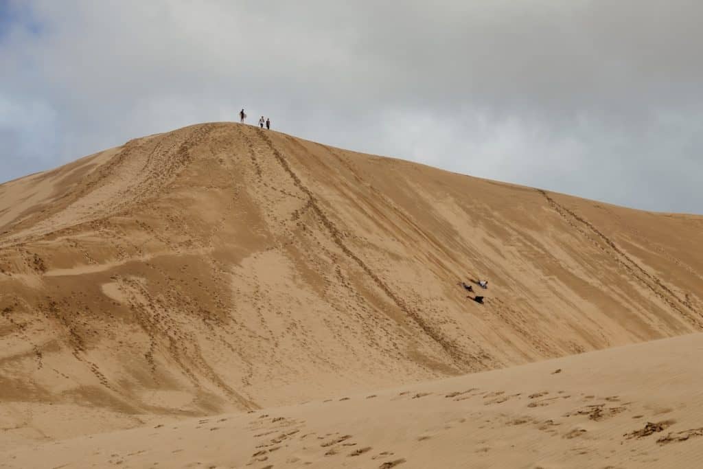
At the northern end is Te Paki Sand Dunes, which are massive dunes up to 150 metres high. There are sandboards to rent at the bottom for the brave ones among you.
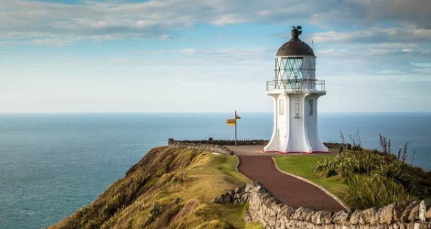
Standing at Cape Reinga itself, watching the Tasman and the Pacific visibly collide off the headland, is one of those moments that photographs never quite capture. If this is where you want to halt for a while, our favourite accommodation here is Lakeview BnB.
The Journey South — Hokianga and the Kauri Coast
Rather than retracing the same road home, the loop continues south along the west coast through the Hokianga Harbour, a quieter, more remote stretch with its own distinct character — sand dunes, scattered Māori settlements, and a sense of being genuinely off the main tourist track.
This route also passes through Waipoua Forest, home to Tāne Mahuta, the largest known kauri tree in New Zealand. Walking the short boardwalk to stand beneath a tree that’s been growing for an estimated 1,500 years is a quiet, grounding counterpoint to the wide-open coastlines earlier in the trip.
Practical Notes
- Fuel up before Kaitaia — stations thin out significantly north of there
- Book Bay of Islands accommodation ahead in peak summer (December–February)
- Allow a full day for the Cape Reinga return trip from the Bay of Islands if not staying further north
- Sand driving on Ninety Mile Beach is genuinely risky without local knowledge — a guided tour is the safer option
- Waipoua Forest’s Tāne Mahuta walk is wheelchair and pushchair accessible via boardwalk
Author: Mike Fernandez
Hey! I've worked for Nection Ltd since 2018 and been writing for Tripplanner since late 2025. I love it that this is a place where people can tell everyone about where they're from and hopefully bring tourists in. I'm from Matakana (which is why there's so many listings from there!) I had fun making them, I hope you like them too.