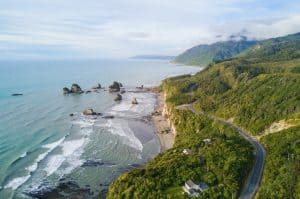
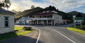
New Zealand has more coastline per capita than almost any country on Earth — 15,134 kilometres of it, including offshore islands. The country’s coastal walking tracks range from two-hour strolls on golden sand to multi-day Great Walks through national parks. What distinguishes New Zealand’s coastal walking from comparable destinations is the combination of access (much of the coast is publicly accessible under the Queen’s Chain), diversity (subtropical mangrove estuaries in the north, fjords and penguin colonies in the south), and the near-total absence of crowds on most tracks outside of peak summer weeks. These ten walks represent the full range — from fully accessible seafront promenades to remote overnight routes.
1. Abel Tasman Coast Track
📍 Abel Tasman National Park, Nelson/Tasman
The Abel Tasman Coast Track is one of New Zealand’s 11 Great Walks and the country’s most walked overnight track. The 60-kilometre route passes golden beaches, granite headlands, and tidal inlets through New Zealand’s smallest national park. The track can be walked north to south or south to north in 3–5 days, with DOC huts and campsites throughout. Water taxis from Marahau and Kaiteriteri allow visitors to walk sections of the track and return by boat — making it accessible to day visitors as well as multi-day walkers.
Best for: Multi-day walking, families, swimming, kayaking
Local tip: The section from Anchorage to Bark Bay (4 hours) is widely considered the best single day on the track — book the water taxi to Anchorage and walk back.
2. Mangawhai Cliffs Walkway
📍 Mangawhai Heads, Northland
The Mangawhai Cliffs Walkway climbs from the white sand of Mangawhai Heads Beach to clifftop lookouts high above the Pacific, then descends a long flight of steps to a natural rock archway. On a clear day the views take in Te Whara/Bream Head, Taranga/Hen Island, Te Hauturu-o-Toi/Little Barrier Island and Aotea/Great Barrier Island, framed by nīkau palms and pōhutukawa that flower crimson in early summer. The full walk is about 9 kilometres and takes 2–3 hours: out along the cliff track, then back along the rocky shoreline at low to mid tide, making it one of Northland’s most rewarding half-day coastal loops.
Best for: Half-day walk, coastal views, photography, moderate fitness
Local tip: Start 2–3 hours before low tide so you can return along the beach. If water is surging through the archway, go back over the cliff track instead.
3. Otago Peninsula Walks
📍 Dunedin, Otago
The Otago Peninsula southeast of Dunedin offers a cluster of short coastal walks with exceptional wildlife access. The Sandfly Bay track (45 minutes return) descends to a beach where New Zealand sea lions (rāpoka) haul out year-round — one of the only places in the world where a visitor can walk to within 20 metres of wild sea lions on a public beach. Nearby Taiaroa Head hosts the world’s only mainland royal albatross (toroa) colony, with birds nesting within metres of a public viewing area.
Best for: Wildlife, photography, half-day walks, families
Local tip: Sandfly Bay is best visited in the afternoon when sea lions are most active on the beach after morning fishing.
4. Cape Reinga to Twilight Beach (Te Paki Coastal Track)
📍 Te Paki, Northland
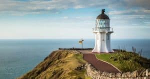
The westernmost sections of the 48-kilometre Te Paki Coastal Track drop from the Cape Reinga lighthouse to Te Werahi Beach (45 minutes return), then continue around 7 kilometres along the beach and over the headland to Twilight Beach (about 3 hours one way). The walk passes through one of the most spiritually significant landscapes in Māori tradition — the cape is believed to be the departure point for souls beginning their journey to Hawaiki after death. The beach is broad and backed by high sand dunes, with views of the Tasman Sea and Pacific Ocean meeting at the cape.
Best for: Cultural significance, remote beaches, photography
Local tip: Short on time? The 45-minute return track from the lighthouse down to Te Werahi Beach gives superb views of Cape Maria van Diemen.
5. Queen Charlotte Track (Coastal Sections)
📍 Marlborough Sounds, Marlborough
The Queen Charlotte Track runs 73 kilometres through the Marlborough Sounds from Ship Cove — Captain Cook’s favourite anchorage on his Pacific voyages — to Anakiwa. The coastal sections above Queen Charlotte Sound offer continuous water views, with the track passing through regenerating native bush above narrow fjord-like inlets. The track is accessible by water taxi from Picton, and bag transfer services allow walkers to travel light between sections. The track is also popular with mountain bikers outside the peak summer months.
Best for: Multi-day walking, cycling, water views, moderate fitness
Local tip: The Ship Cove to Furneaux Lodge section (15km, 5 hours) is the most scenic and historically significant day on the track.
6. Banks Peninsula Track
📍 Akaroa, Canterbury
The Banks Peninsula Track is a privately operated 31-kilometre walk, done over three days (or two for fit hikers), around the dramatic volcanic coastline of Banks Peninsula, 80 kilometres east of Christchurch. The track crosses private farmland with exclusive access to clifftop views, hidden coves, and sea caves, passing through the habitat of the Hector’s dolphin — one of the world’s smallest and rarest dolphins. Hut and cottage accommodation along the way is included in the track fee.
Best for: Boutique multi-day experience, seclusion, wildlife
Local tip: Book 6–12 months ahead for summer dates — capacity is strictly limited and the track sells out annually.
7. Paekakariki Escarpment Track
📍 Paekakariki, Wellington
The Paekakariki Escarpment Track is a 10-kilometre one-way walk along the Kāpiti Coast north of Wellington, running high above the Tasman Sea with continuous views of Kāpiti Island — one of New Zealand’s most successful predator-free wildlife sanctuaries. The track connects Pukerua Bay and Paekakariki railway stations, making it one of the most practical point-to-point walks in New Zealand (train back from either end). Around 1,200 steps and two swing bridges make it a solid 3–4 hour workout.
Best for: Half-day walk, train access, Wellington visitors, views of Kāpiti Island
Local tip: Walk north to south (Pukerua Bay to Paekakariki) to face the views as you walk rather than have them behind you.
8. New Plymouth Coastal Walkway
📍 New Plymouth, Taranaki
New Plymouth’s Coastal Walkway is a 13-kilometre paved path running along the waterfront from Port Taranaki to Bell Block, with Mount Taranaki (2,518m) visible to the south on clear days. The path passes the Len Lye Centre, Puke Ariki museum, and the Te Rewa Rewa Bridge — a bone-white arch bridge framing views of the mountain that has become one of the most photographed structures in New Zealand. The walkway is flat and paved, making it suitable for buggies and most wheelchairs.
Best for: Accessible walking, families, cycling, architecture
Local tip: Visit Te Rewa Rewa Bridge at dawn when the mountain is clear and the light is soft — the view through the arch is exceptional.
9. Kaikōura Peninsula Walkway
📍 Kaikōura, Canterbury
The Kaikōura Peninsula Walkway is a 12-kilometre loop walk (3–4 hours) around the rocky peninsula jutting into the Pacific south of Kaikōura township. The walk passes colonies of New Zealand fur seals (kekeno) that haul out within metres of the track, and offers views of the Kaikōura Ranges rising directly from the sea. Sperm whales, dusky dolphins, and Hector’s dolphins are regularly visible offshore. The town of Kaikōura itself sits between the Kaikōura Range (2,000m+) and the coast, making it one of New Zealand’s most dramatically sited communities.
Best for: Wildlife, photography, half-day walk, families
Local tip: Walk the track clockwise (starting at the South Bay end) to reach the main seal colony after warming up on the gentler southern section.
10. Coromandel Coastal Walkway
📍 Fletcher Bay to Stony Bay, Coromandel
The Coromandel Coastal Walkway is a 7-kilometre, 3-hour track at the northernmost tip of the Coromandel Peninsula, accessible only by unsealed road or water taxi. The track traverses cliff tops with views of the Hauraki Gulf, Mercury Islands, and on clear days, Little Barrier Island (Hauturu). Both ends of the track are accessible by water taxi from Coromandel Town, making it one of the most spectacular and least-walked coastal tracks in the North Island.
Best for: Remote scenery, small groups, moderate fitness
Local tip: Book the water taxi round trip from Coromandel Town — the gravel access roads to both ends are slow going.
All walks listed here have corresponding listings, maps, and visitor tips on tripplanner.nz. Use the interactive map to find accommodation near each trailhead and plan your route across multiple walks.

Author: Tripplanner Team
The Tripplanner.nz editorial team, based in Matakana north of Auckland. We write the regional guides and road trips, and add listings for places we think every visitor should know about, alongside the locals who share their own favourite spots here.