New Zealand’s tourism infrastructure concentrates visitors efficiently: Queenstown, Rotorua, Milford Sound, and the Abel Tasman handle the majority of international visitor traffic, while a long tail of extraordinary places sees a fraction of those numbers. This concentration is partly a result of how travel is marketed, partly infrastructure (some places have no accommodation), and partly the simple fact that New Zealand is large relative to its road network. The places below are not unknown to New Zealanders — locals know them well — but they rarely appear in the top ten lists that shape most international itineraries. Each offers something that the headline destinations cannot: space, quiet, or a level of access to wildlife and landscape that crowds make impossible elsewhere.
1. Curio Bay, Catlins Coast
📍 The Catlins, Southland
Curio Bay on the Catlins Coast of Southland contains a 180-million-year-old petrified forest — the best-preserved Jurassic fossil forest in the Southern Hemisphere — exposed on a wave-cut rock platform accessible at low tide. The same bay is home to a resident population of yellow-eyed penguins (hoiho), one of the world’s rarest penguin species, which come ashore at dusk year-round. Hector’s dolphins are regularly seen in the bay. The Catlins Coast road between Balclutha and Invercargill is one of the least-driven scenic routes in New Zealand.
Best for: Wildlife, geology, remote coastal scenery
Local tip: Arrive at Curio Bay 45 minutes before sunset and wait quietly above the beach — penguins are predictable in their return timing.
2. Oamaru Victorian Precinct & Steampunk Capital
📍 Oamaru, North Otago
Oamaru’s Victorian Heritage Precinct contains New Zealand’s largest collection of Victorian commercial buildings, built mainly in the 1870s and 1880s from the distinctive cream-coloured Oamaru stone. The town has reinvented itself as New Zealand’s Steampunk capital, with permanent public installations, an annual Steampunk festival, and a gallery of Steampunk art. A colony of little blue penguins (kororā) nests in disused quarries at the edge of the precinct and can be watched from a purpose-built viewing area nightly. The precinct is within 400 metres of the State Highway 1 but is missed by most through-travellers.
Best for: Art and architecture, quirky culture, penguins, families
Local tip: Book the evening viewing at the Oamaru Blue Penguin Colony — the penguins come ashore around dusk, and summer sessions fill up.
3. Mahia Peninsula
📍 Hawke’s Bay / Gisborne border
Mahia Peninsula is a low-lying limestone peninsula on the East Coast of the North Island, surrounded by water on three sides and connected to the mainland by a narrow neck. The peninsula has a small permanent population, two surf beaches on its western and eastern shores, sheltered harbour-side baches (holiday homes), and a launch pad — Rocket Lab’s Launch Complex 1 sits near the peninsula’s southern tip and has hosted dozens of orbital launches since 2018. The combination of isolation, surf, fishing, and an active rocket launch site makes Mahia unlike any other place in New Zealand.
Best for: Surfing, fishing, unusual experiences, off-grid relaxation
Local tip: Check Rocket Lab’s launch schedule before visiting — watching an orbital rocket launch from a nearby public vantage point is a remarkable and still mostly unknown experience.
4. Forgotten World Highway, SH43
📍 Taumarunui to Stratford, Taranaki/King Country
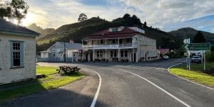
State Highway 43 between Taumarunui and Stratford is known as the Forgotten World Highway — a 150-kilometre road through remote hill country with only one small settlement along the way, the single-lane, hand-dug Moki Tunnel, and views of landscape virtually unchanged since European settlement. The tiny settlement of Whangamōmona declared itself an independent republic in 1989 and still issues its own passport stamps at the Whangamōmona Hotel. The drive takes 3–4 hours and is best done with a picnic — there are no petrol stations or shops along the route.
Best for: Road tripping, unusual history, photography, adventure driving
Local tip: Fill up with fuel in Taumarunui or Stratford and stop at the Whangamōmona Hotel for lunch and a Republic passport stamp. The last gravel section, through the Tāngarākau Gorge, was sealed in 2025. See our Forgotten World Highway road trip for the full route.
5. Karamea, West Coast
📍 Karamea, West Coast
Karamea is the end of the road on the West Coast of the South Island — State Highway 67 terminates here, with nothing beyond but the Heaphy Track, which starts from town and traverses the Kahurangi National Park to Golden Bay (4–6 days on foot). The Oparara Basin, 25 kilometres north of Karamea, contains a network of limestone arches and caves (including the Oparara Arch at 43 metres high and 219 metres long — the largest limestone arch in New Zealand) set in unmodified kahikatea rainforest.
Best for: Serious trampers, remote nature, limestone geology, solitude
Local tip: The Oparara Arch and Moria Gate Arch walks (each about 1–1.5 hours return) suit most fitness levels — no technical skills required.
6. Matakana Village & Tāwharanui Peninsula
📍 Matakana, Auckland Region
Matakana is a wine and artisan food village 65 kilometres north of Auckland, home to a Saturday farmers market, a boutique cinema, a cluster of respected wineries, and the Matakana Country Park. Twenty minutes further north, Tāwharanui Regional Park occupies a peninsula protected by a predator-proof fence — one of the most successful mainland wildlife sanctuaries in the Auckland region — where tīeke (saddleback) and other native birds fill the dawn chorus and kiwi can be heard after dark. The park’s northern beaches are among the least visited in the Auckland region despite being accessible by sealed road.
Best for: Food and wine, Auckland day trips, families, wildlife
Local tip: Combine the Saturday morning Matakana Farmers Market with an afternoon at Tāwharanui beach for a near-perfect Auckland day out.
7. Lake Hāwea, Central Otago
📍 Lake Hāwea, Otago
Lake Hāwea lies in a parallel glacial valley just east of Lake Wānaka; at The Neck, a narrow rocky ridge, the two lakes come within a kilometre of each other. While Wānaka draws substantial visitor numbers, Lake Hāwea township, 15 kilometres north of Wānaka, and its turquoise glacial lake see a fraction of that traffic. The lake is 35 kilometres long, 392 metres deep at its deepest point, and surrounded by tussock-covered mountains with no commercial development on its eastern shore. The Lake Hāwea Walkway follows the lake’s edge from the township for 8 kilometres on a formed track.
Best for: Peace and quiet, scenery equal to Wanaka, fishing, swimming
Local tip: DOC’s Kidds Bush Reserve campsite on the lake’s western shore is bookable online and one of the best-value lakeside camping spots in Central Otago.
8. Castlepoint, Wairarapa
📍 Castlepoint, Wairarapa
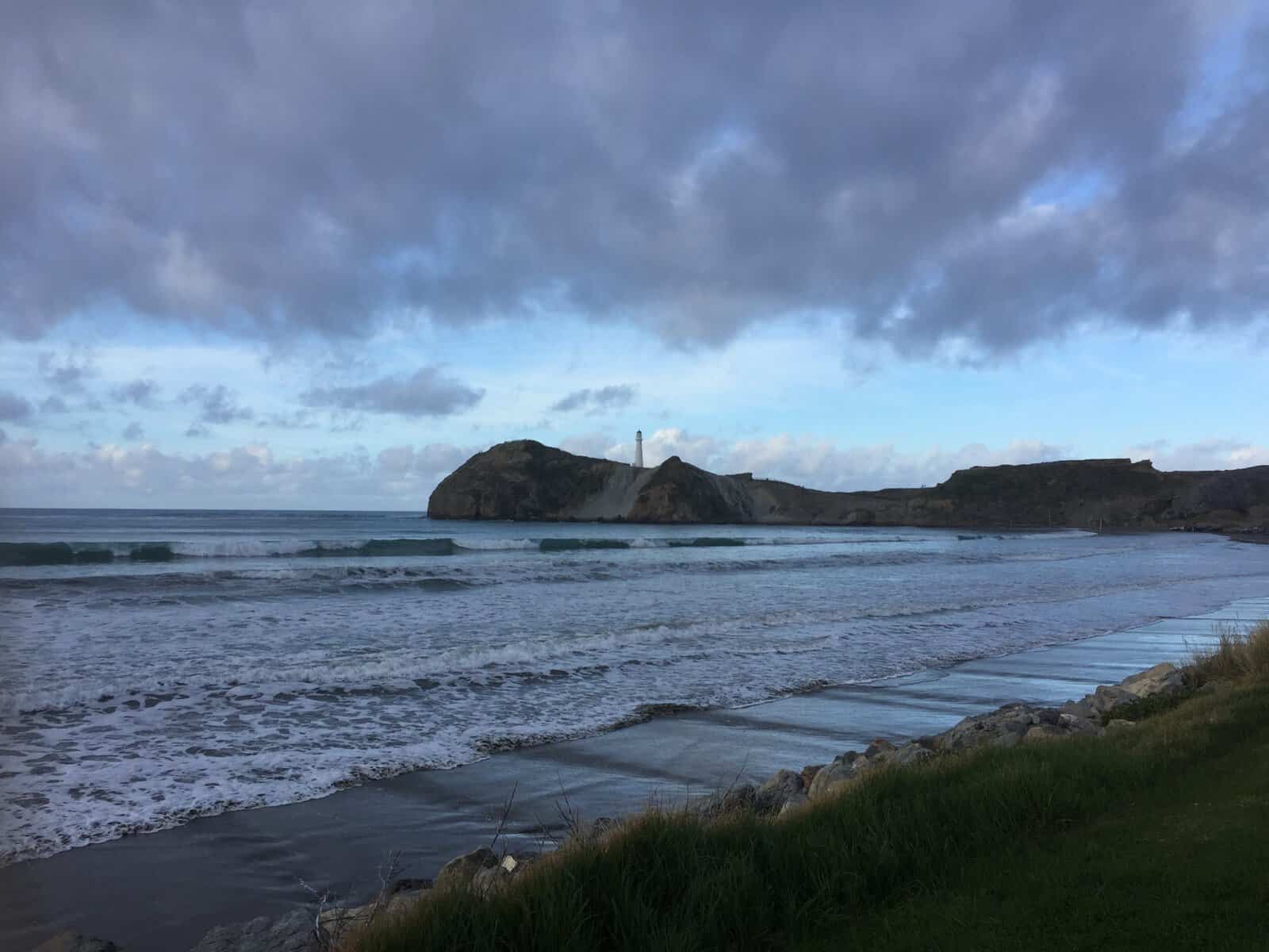
Castlepoint is a remote coastal settlement on the Wairarapa’s Pacific coast, about 65 kilometres east of Masterton via a winding rural road. The settlement is dominated by the 162-metre Castle Rock and a limestone reef with a lighthouse (built 1913) at its tip, a tidal lagoon behind the reef, and surf beach extending north along the coast. A 45-minute loop track climbs to the lighthouse via the reef with views along the Wairarapa coast. Castlepoint has a small general store, a motor camp, and very little else — which is precisely why it remains relatively uncrowded despite being the most spectacular coastal location in the lower North Island.
Best for: Remote coastal drama, rock pools, lighthouse walk, fishing
Local tip: The drive from Masterton takes under an hour. Check tide times so you can explore the reef and rock pools at low tide.
9. Punakaiki Pancake Rocks (Off-Peak)
📍 Paparoa National Park, West Coast
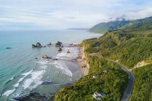
Punakaiki’s Pancake Rocks are moderately well-known but are almost always listed in the same breath as a quick roadside stop. The rocks — layered limestone formations resembling stacks of pancakes, carved by a process called stylobedding — are more dramatic than most photos suggest, particularly the blowholes during high tide and westerly swells. The short loop track from the car park is busy, but the nearby Pororari River Track, which joins the end of the Paparoa Track (one of New Zealand’s Great Walks), leaves the crowds behind within minutes.
Best for: Geology, short walks, West Coast road trips
Local tip: Check tide times before visiting — the blowholes require a high tide and a westerly swell to perform. The MetService and tide chart combination predicts this.
10. Te Waihou Pūkuri / Blue Spring, Putāruru
📍 Putāruru, Waikato
Te Waihou Pūkuri (the Blue Spring) near Putāruru in the Waikato is the source of much of New Zealand’s bottled water, emerging from a hillside at a constant 11°C with exceptional clarity. The Te Waihou Walkway follows the spring-fed river through farmland and native bush, with the water a vivid turquoise-blue from its exceptional clarity and the constant low temperature preventing algae growth. Most visitors walk the short section from the Leslie Road car park to the spring and return the same way. Swimming is not permitted. Despite its remarkable appearance, the Blue Spring remains largely unknown outside New Zealand.
Best for: Unusual natural phenomena, easy walking, families, photography
Local tip: Visit in the morning for the best light on the water — the colour is most vivid when the sun is low and the surface is calm.
All ten hidden gems are listed on tripplanner.nz with photos, maps, visitor reviews, and nearby accommodation options. Use the interactive map to route between multiple hidden gems and discover what’s nearby.

Author: Tripplanner Team
The Tripplanner.nz editorial team, based in Matakana north of Auckland. We write the regional guides and road trips, and add listings for places we think every visitor should know about, alongside the locals who share their own favourite spots here.